Maps of K-State Campus
1875-1940
Willard Maps: 1875 - 1939
Harris Map: 1928
Sanborn Fire Insurance Maps: 1905 - 1940
Facilities Map: 1940
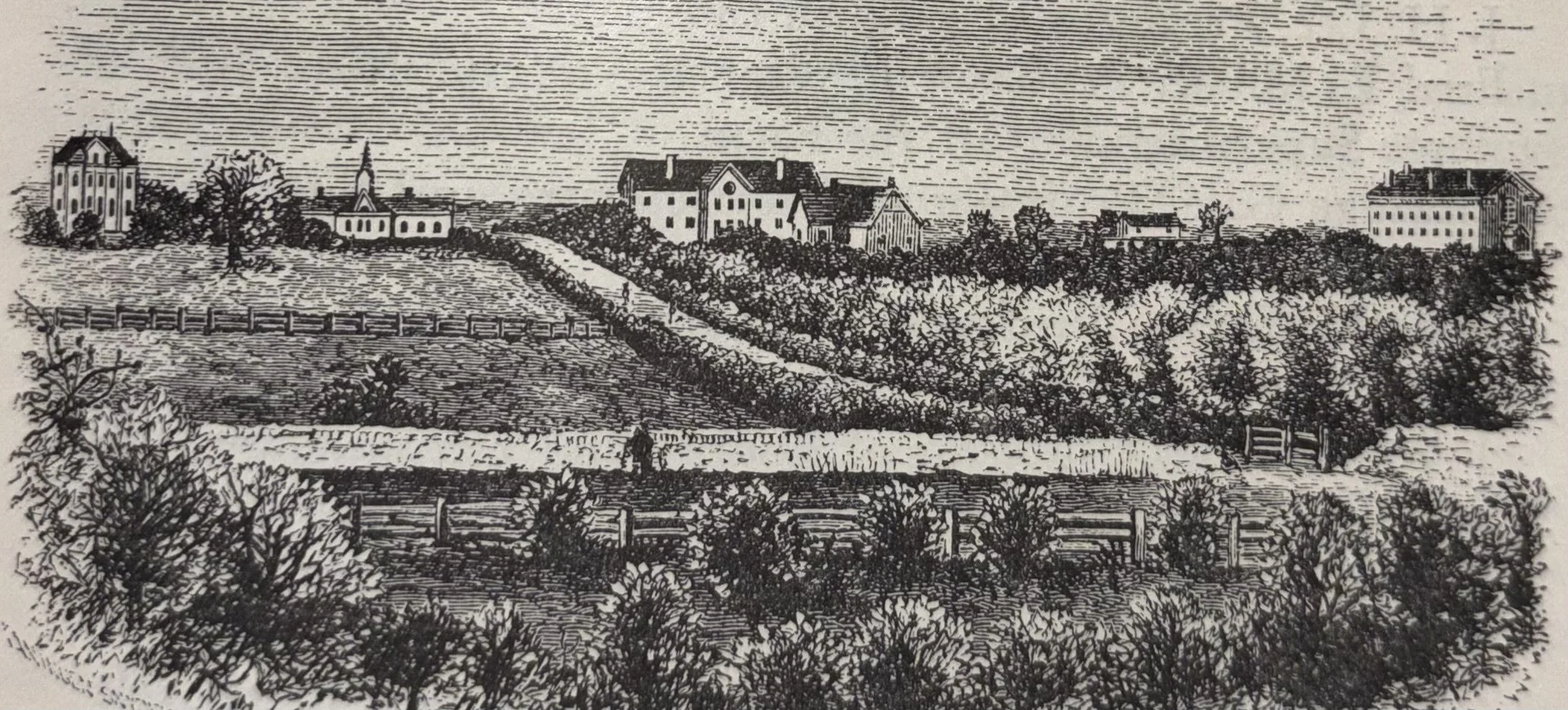
Illustrated photo of KSAC Campus from the First Biennial Report of the State Board of Agriculture, 1877-1878. Looking Northwest.
Willard Maps
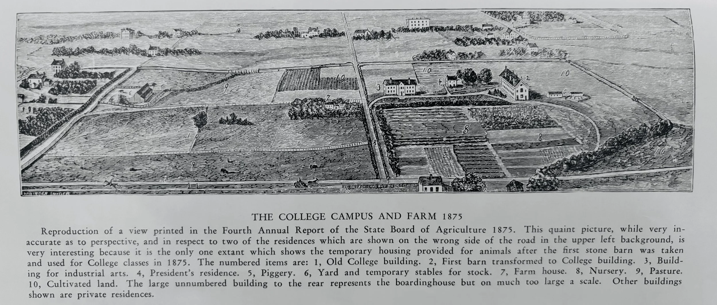
Willard, Julius Terrass. History of the Kansas State College of Agriculture and Applied Science (Manhattan, KS: Kansas State College Press, 1940), 43, 1875.
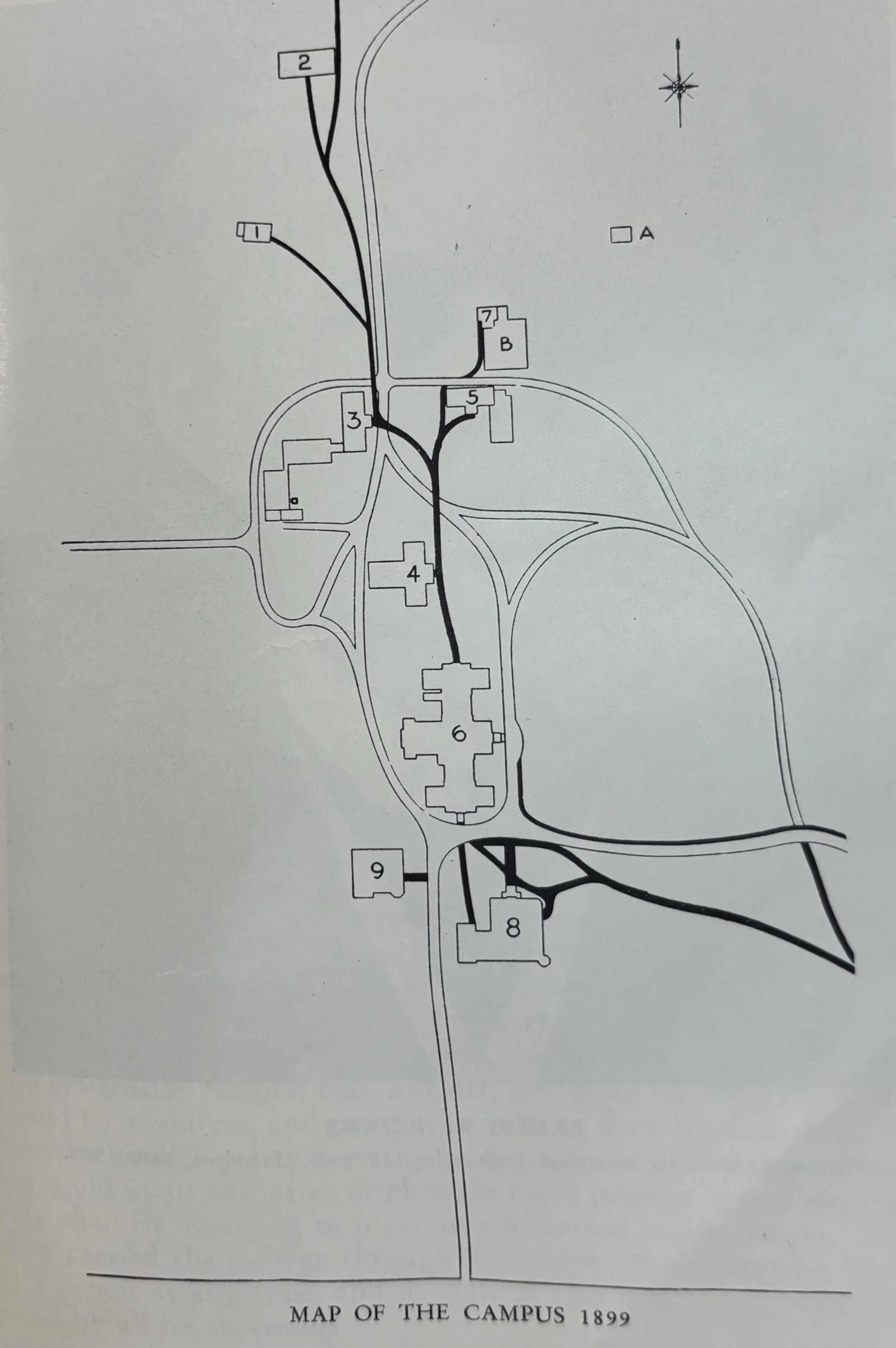
Willard, Julius Terrass, History of the Kansas State College of Agriculture and Applied Science (Manhattan, KS: Kansas State College Press, 1940), 127, 1899, “Map showing location of buildings, roads, and walks on the campus in 1899. The buildings are numbered in the order of their erection.”
Residence of the professor of agriculture, built in 1866 by Mrs. N. O. Preston.
Armory, erected in 1873 as one wing of a barn.
Mechanics Hall, erected in 1875. (Regnier Hall)
Chemical laboratory, erected 1876. (Holtz Hall)
Horticulture Hall, erected in 1876.
Main College Building, erected 1879-1888. (Anderson Hall)
Horticulture and Entomology Offices and Laboratory, erected 1888
Library and Agricultural Science Hall, erected 1894. (Fairchild Hall)
Domestic Science Hall, erected 1898. (Kedzie Hall).
A) Horticulture Barn, erected in 1889.
B) Propagating Houses, erected in 1888.
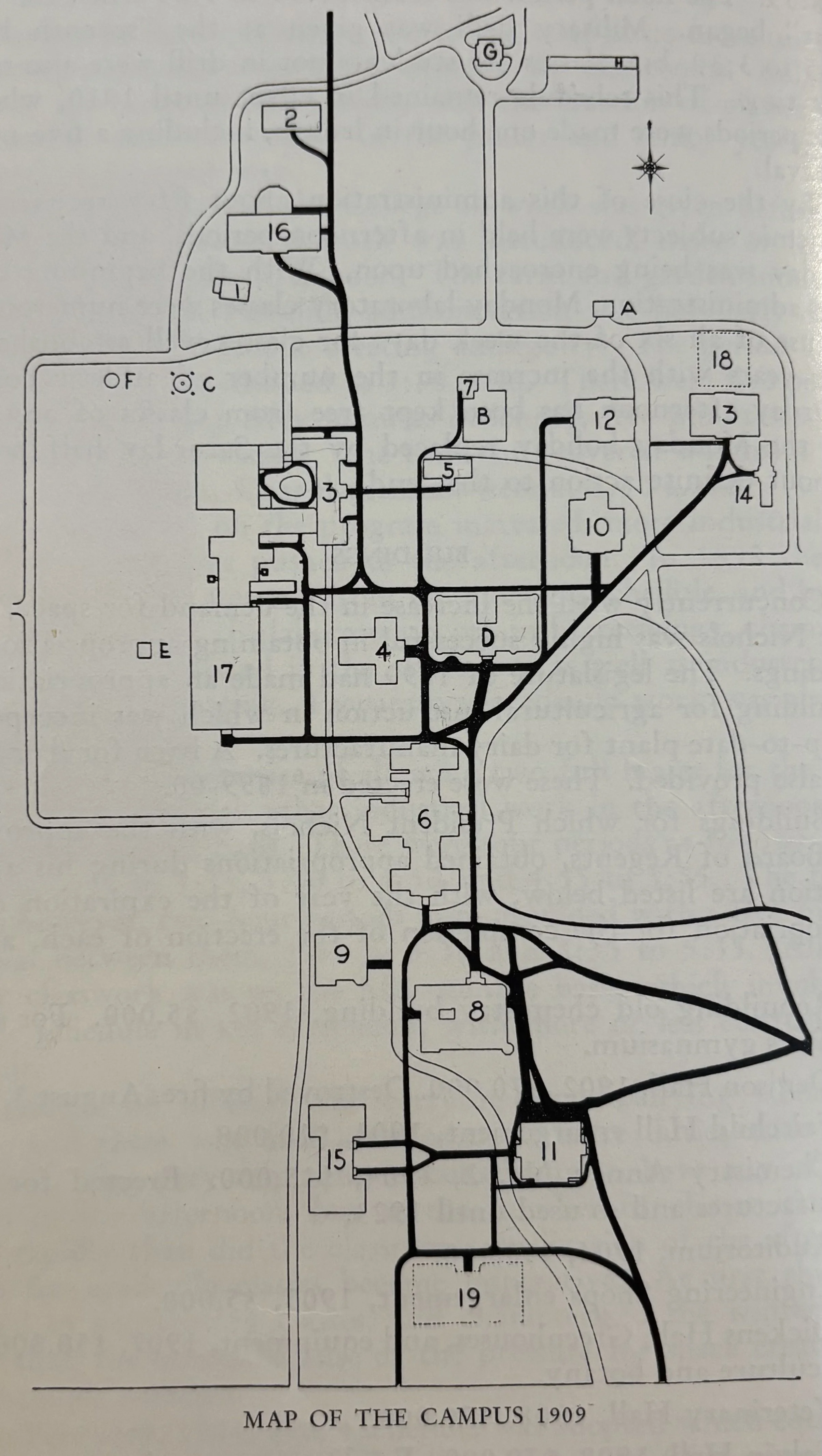
Willard, Julius Terrass, History of the Kansas State College of Agriculture and Applied Science, (Manhattan, KS: Kansas State College Press, 1940), 156, 1909, “Map showing location of buildings, roads, and walks on the campus in 1899. The buildings are numbered in the order of their erection.”
Residence of the custodian, built in 1866 by Mrs. N. O. Preston.
Armory, erected in 1873 as one wing of a barn.
Mechanics Hall, the original shops structure, erected in 1875, and extensive additions (Regnier Hall)
Gymnasium for women, erected 1876 as a chemical laboratory. (Holtz Hall)
Old Horticulture Hall, erected in 1876.
Anderson Hall, erected 1879-1888.
Horticulture and Entomology Offices and Laboratory, erected 1888
Fairchild Hall, erected 1894.
Kedzie Hall, erected 1898.
Agricultural Hall, erected in 1900. (Holton Hall)
Auditorium, erected in 1904.
Dairy Hall, erected in 1904
Horticulture Hall, erected in 1907. (Dickens Hall).
Plant Museum, erected in 1907.
Domestic Science and Art Hall, erected in 1908. (Calvin Hall)
Veterinary Hall, erected in 1908. (Leasure Hall)
East Section of Engineering Hall, erected in 1909. (Seaton Hall)
Greenhouses, erected in 1910.
Nichols Gymnasium, erected in 1911. (Nichols Hall)
A) Horticulture Barn, erected in 1889.
B) Propagating Houses, erected in 1888.
C) Water Tower, erected in 1904.
D) Physical Science Hall, erected in 1902. (Denison Hall)
E) Gas Producer
F) Gasometer
G) Seed House
H) Horse Sheds
Willard, Julius Terrass, History of the Kansas State College of Agriculture and Applied Science, (Manhattan, KS: Kansas State College Press, 1940), 346, 1939, “Map showing location of buildings, roads, and walks on the campus in 1899. The buildings are numbered in the order of their erection.”
College Hospital, originally built by Mrs. N. O. Preston in 1866 and used as a residence by College presidents, professors of agriculture and the custodian, succession.
Farm Machinery Hall, erected in 1873 as one wing of a barn.
Mechanics Hall, the original shops structure, erected in 1875, and extensive additions (Regnier Hall)
Mathematics Hall, erected as a chemical laboratory in 1876. It has been altered several times, and in 1939 was much changed to adapt it to the use of the department of mathematics.
Illustrations Hall, was Old Horticulture Hall, erected in 1876.
Anderson Hall, erected 1879-1888.
Nurses’ quarters, erected 1888, for Horticulture and Entomology Offices and Laboratory
Fairchild Hall, erected 1894, for the library and science in 1894, enlarged 1903, and remodeled 1927
Kedzie Hall, erected 1898, for Domestic Arts, Home Economics, and now used for English, Journalism, and Printing.
Education Hall, former Agricultural Hall, erected in 1900. (Holton Hall)
Auditorium, erected in 1904.
Chemical Engineering Hall, former Dairy Hall, erected in 1904
Dickens Hall, erected in 1907.
Plant Museum, erected in 1907.
Calvin Hall, erected in 1908.
Veterinary Hall, erected in 1908. (Leasure Hall)
East Section of Engineering Hall, erected in 1909. (Seaton Hall)
Greenhouses, erected in 1910.
Nichols Gymnasium, erected in 1911. (Nichols Hall)
Waters Hall, east wing, erected in 1913.
Stock judging pavilion, erected in 1913.
Engineering Hall, central and west sections erected in 1920.
Thompson Hall, erected in 1922, used for institutional economics.
Memorial Building, west wing, built in 1922.
Veterinary Clinics Building, built in 1923. (Burt Hall).
Waters Hall, west wing, erected in 1923.
Residence for the president, built in 1923.
Memorial Stadium, east wing, built in 1924.
Van Zile, a residence for women students, erected in 1926.
Library, erected in 1927. (Farrell/Hale Library).
Greenhouses, built in 1927.
Heat, Power and Service Building, erected in 1928.
Physical Science Building, erected in 1939. (Willard Hall)
Greenhouses, erected in 1939.
Harris Map
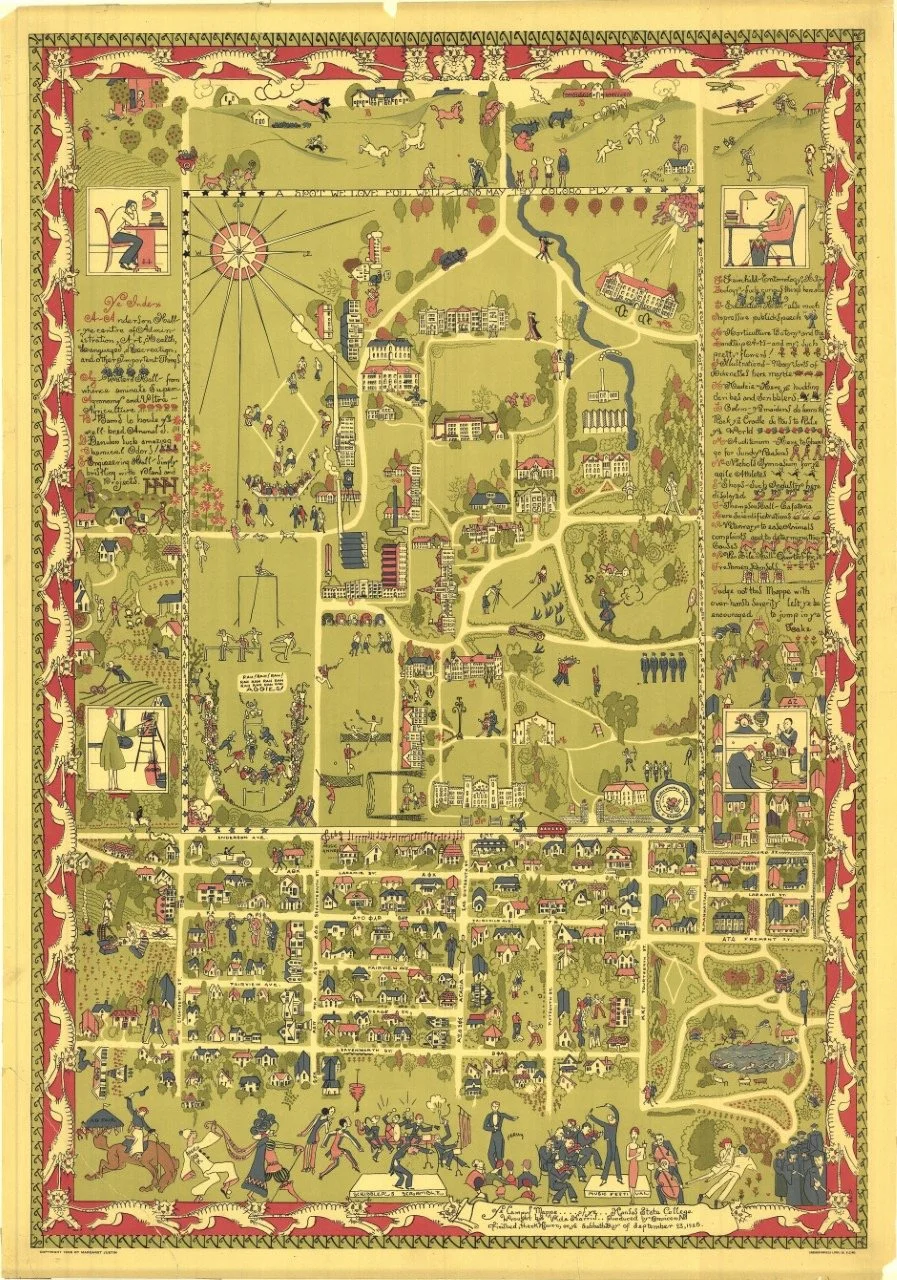
1928 Vida Harris Map of KSU Campus, Marianna Kistler Beach Museum of Art, (n.d.), https://www.k-state.edu/maps/buildings/BA/
Sanborn Fire Insurance Maps
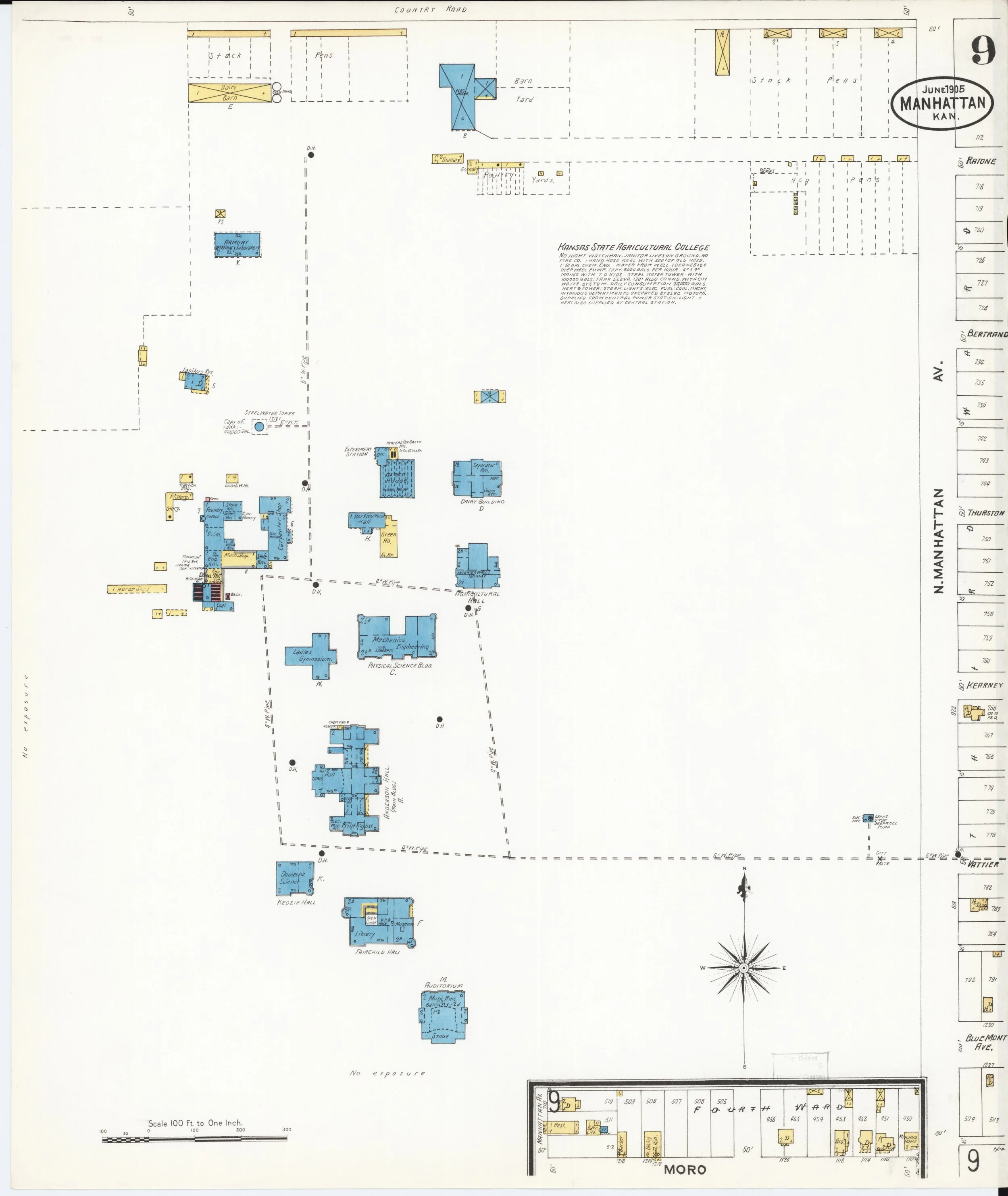
Sanborn Fire Insurance Map from Manhattan, Riley County, Kansas, Sanborn Map Company, Jun, 1905, Map, https://www.loc.gov/item/sanborn03025_004/.
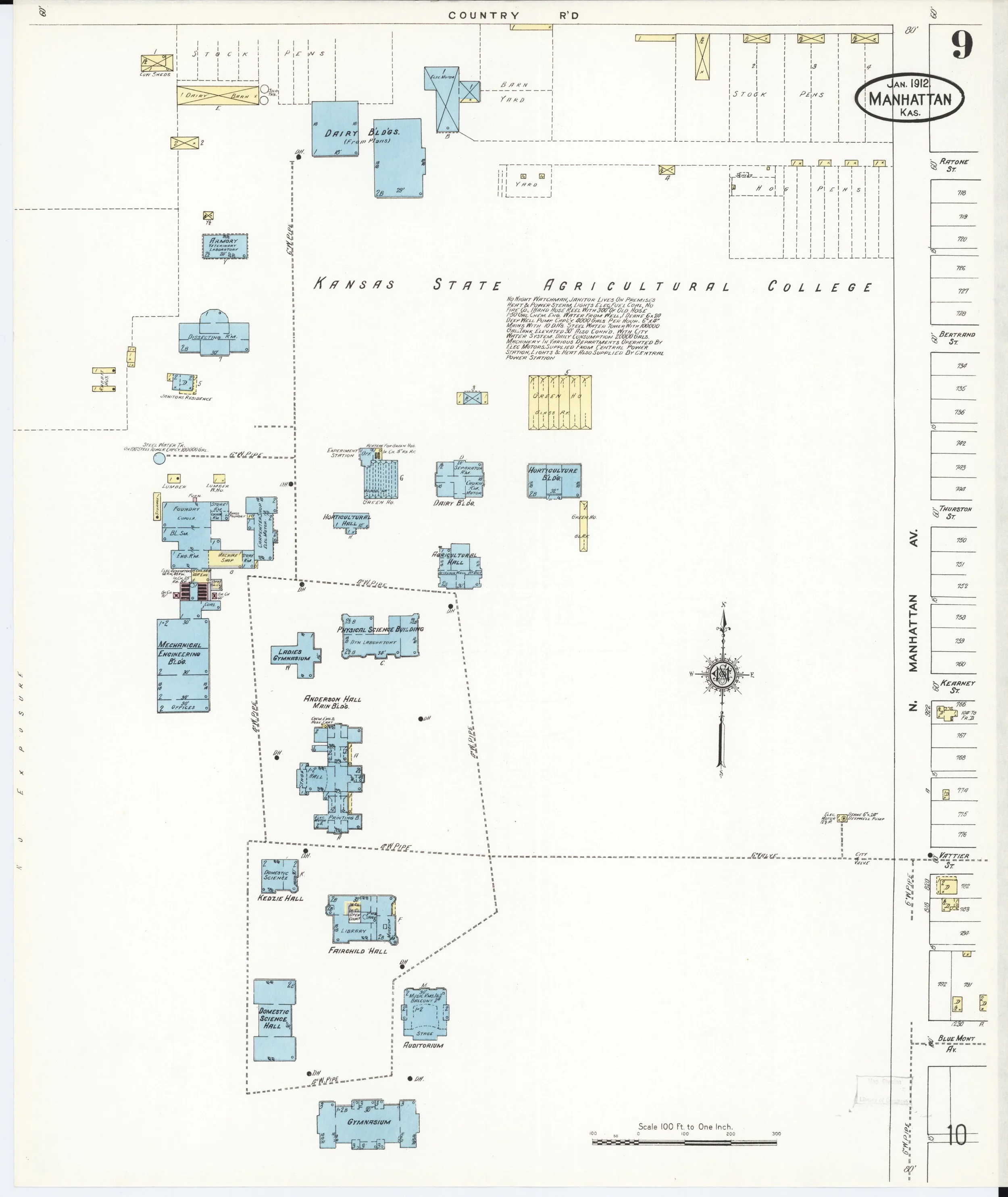
Sanborn Fire Insurance Map from Manhattan, Riley County, Kansas, Sanborn Map Company, Jan, 1912, Map, https://www.loc.gov/item/sanborn03025_005/.
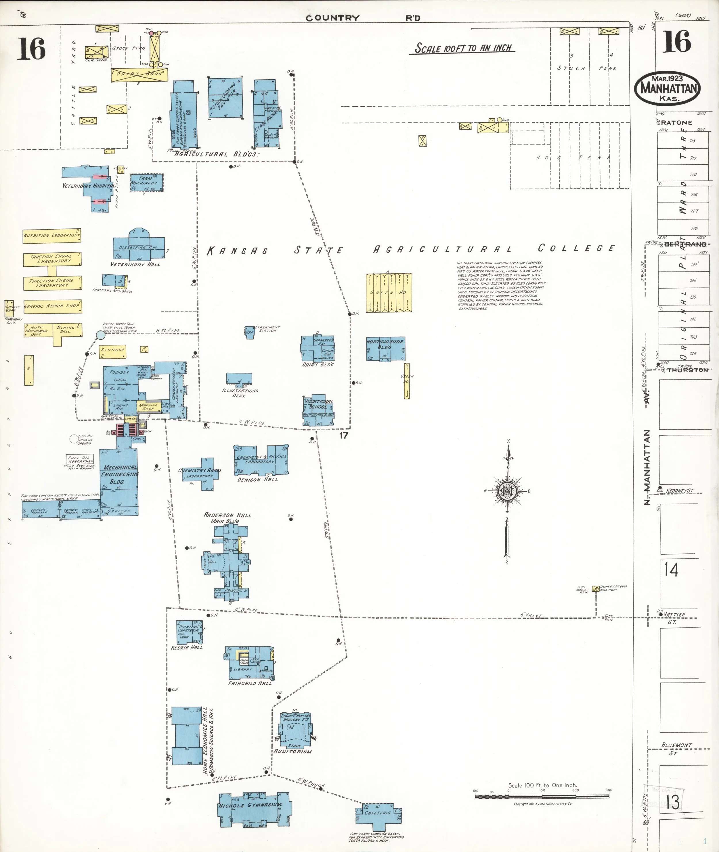
Sanborn Fire Insurance Map from Manhattan, Riley County, Kansas, Sanborn Map Company, Mar, 1923, Map, https://www.loc.gov/item/sanborn03025_006/.
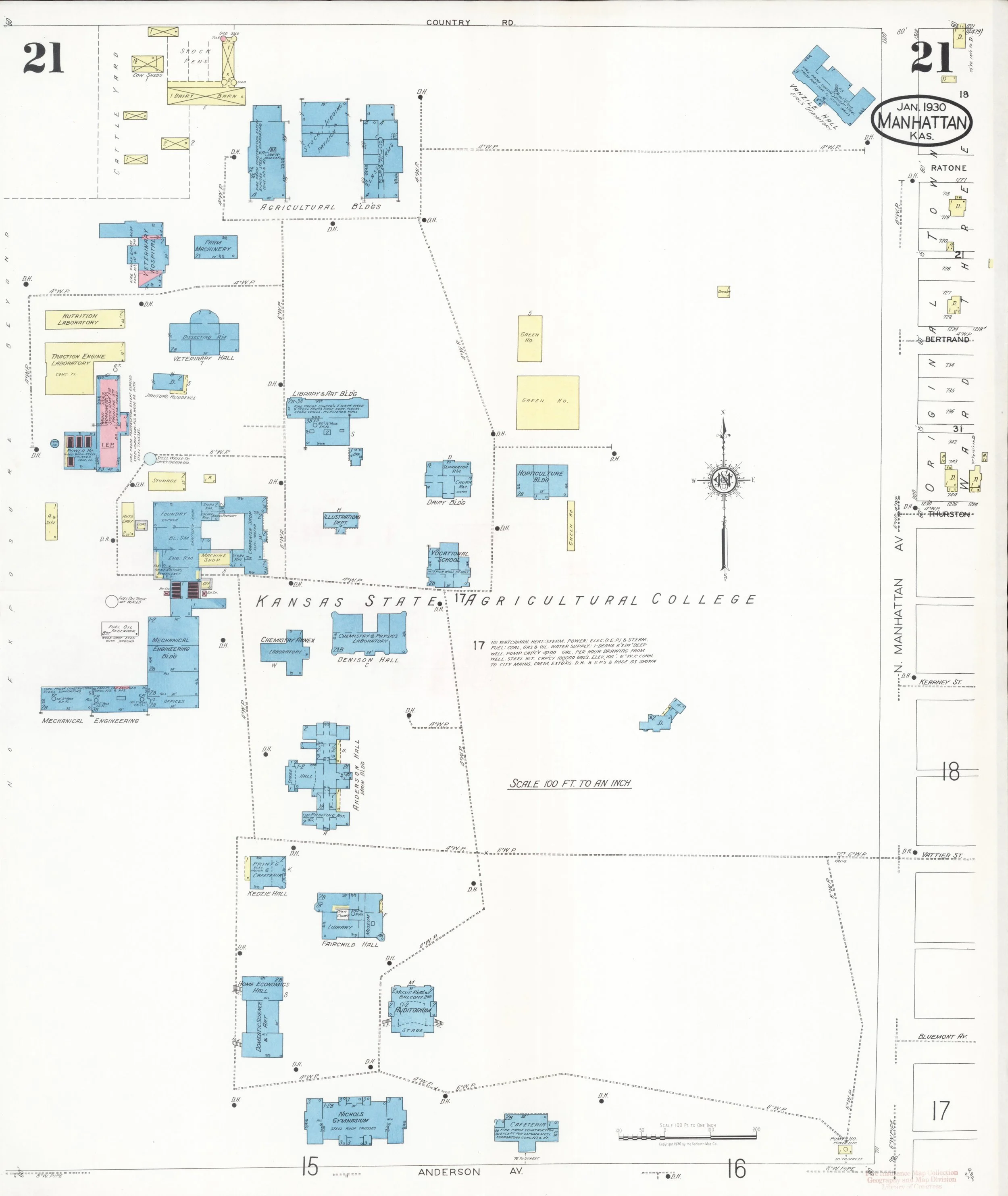
Sanborn Fire Insurance Map from Manhattan, Riley County, Kansas, Sanborn Map Company, Jan, 1930, Map, https://www.loc.gov/item/sanborn03025_007/.
Sanborn Fire Insurance Map from Manhattan, Riley County, Kansas, Sanborn Map Company, Jan-Mar, 1947, Map, https://www.loc.gov/item/sanborn03025_008/.
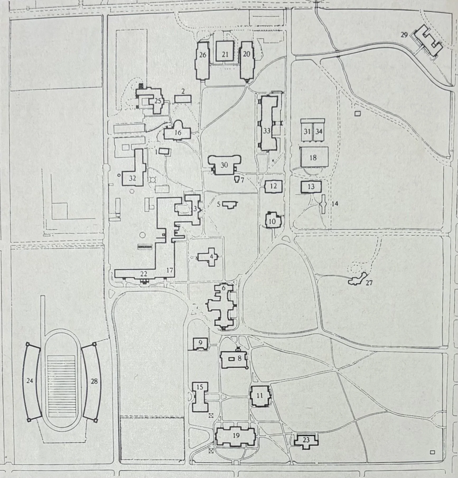
Facilities Map
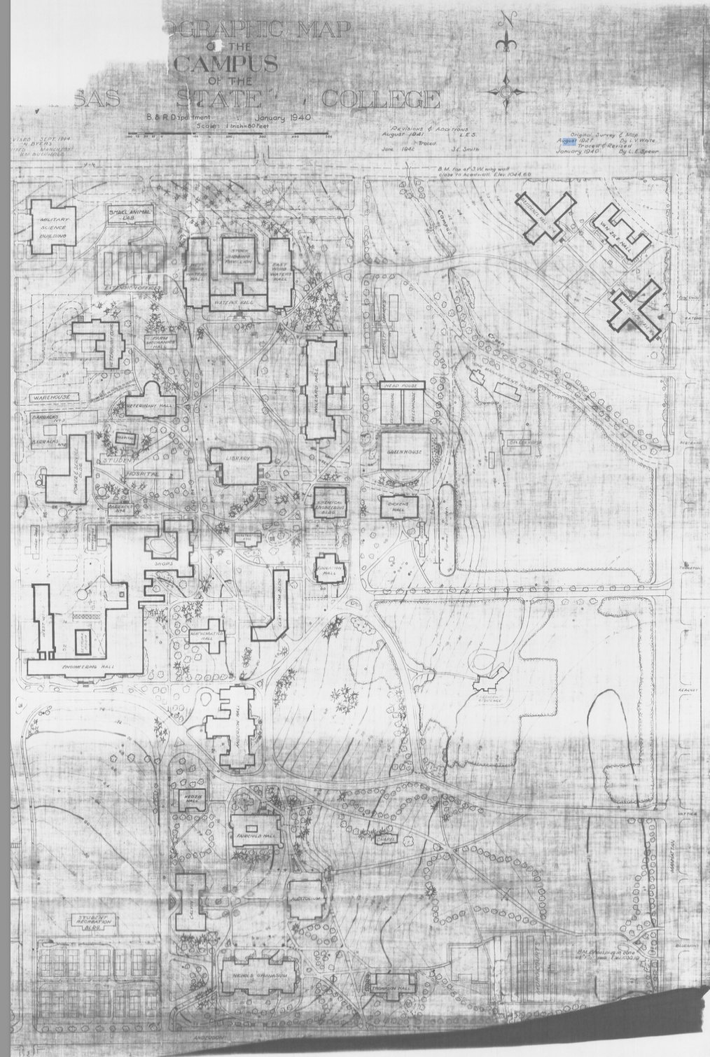
1940 Topographical Campus Map, Courtesy of Department of Space Management, Division of Facilities.